The Abingdon Blog

The Abingdon Blog is a photo record of events and places in Abingdon, Oxfordshire, started on January 1st 2006.

Saturday, 19 January 2008

Gas explosions and Thames high water


Unusually for a Saturday the traffic was bad in town. It built up soon after midday when emergency vehicle sirens could be heard and some thuds that turned out to be explosions.

The Abingdon Herald reports that two gas canisters at a unit off Blacklands Way exploded.

Colwell Drive and the Fairacres trading estate were closed and people evacuated ( it must have been an unusual first day for the new Pets at Home store with their 10% opening offers).


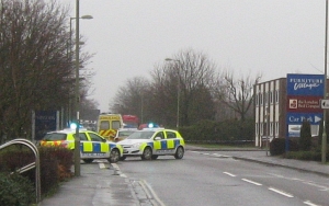
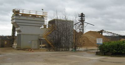
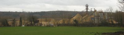
Twelve fire engines were at the scene. The BBC says the unit belongs to Compact GTL, a new UK company that turns gas to liquids.


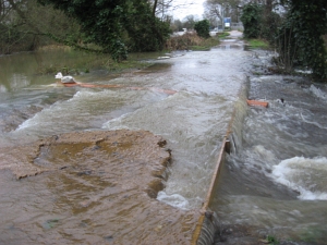
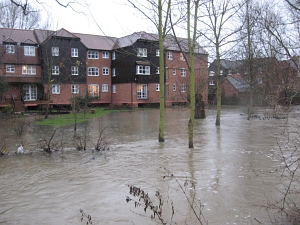
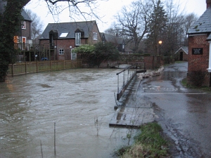
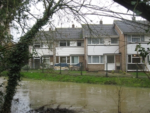
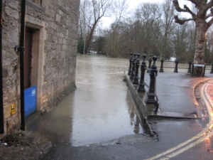
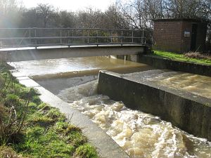
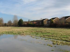
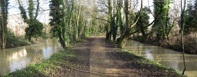
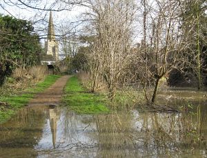
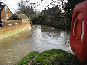
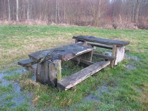
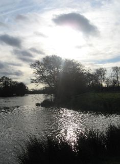
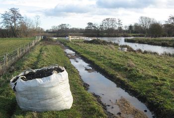
Elsewhere, the new path to the lock, repaired since July, was taking a bit of a battering from all the water.

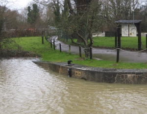
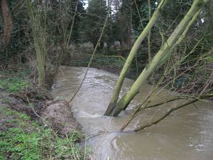
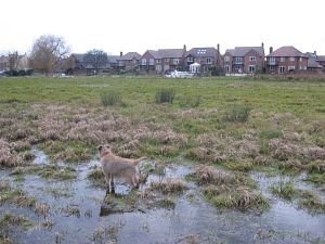
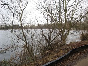
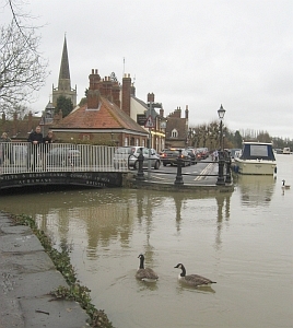
The water level near Abingdon Lock was at 11 feet - a little way below the Jan 2003 high water mark.

Friday, 18 January 2008

Sandbags out again


There were worries yesterday about whether parts of South Abingdon would flood again because of the River Ock (I note on the Environment Agency web site the River Ock is still only at 'flood watch' not 'flood warning'. )

These pictures are from this morning at about 8.

Sandbags have been put out again. Supplies are available from near Homebase on the Fairacres estate. This is St Helen's Mill where the water was rushing against the sides of the building last summer. It has breached the bank a little this time despite the bags.

For advice about using sandbags watch this video.

The River Thames is high but it affects far fewer properties in Abingdon than the River Ock. The wide flood plain the other side ensures for each inch it creeps up this side, it has to go some way the other side.

Thursday, 17 January 2008

Upper and Lower Stream


The River Ock divides into an upper and lower stream near Tesco.

In some places, the river has broken its banks. The houses in the background are in the Ladygrove Estate which were flooded last July.

Upper and lower streams run close together on the Ock Valley Walk into town, and the difference in level is normally far greater.

In places the walk goes underwater.

They streams come together just before joing the Thames.

The Ock has been on Flood Watch since January 11th.

(Update: it got worse than these pictures overnight into Thursday but no sign of anybody being flooded, although it looks a close run thing in places.)

Wednesday, 16 January 2008

On the Run


Last April there was just the shell of the old petrol station and a hole in the ground, and now there is 'On the Run'.

Over the last four or so years, Esso has converted many petrol stations to be 'On the Run'.
On a wet night, like tonight , people can find here a cafe area and a convenience store. Its just off the A34 Marcham interchange, near Tesco.

The petrol price is typical for the area - unfortunately. Prices have not been so high before.

Tuesday, 15 January 2008

Pause for thought


This picnic bench has been near the Thames in Barton Meadows through many winters. It has always appeared robust but is definitely showing its age.

These trees fell into the lower Ock during the July floods last year. The high water will soften their remaining hold on earth.

Over the Marina houses, gulls trail across, and then gather. A few scatter and scout close to ground in search of food, before moving on, back to the rubbish-filled gravel pits south of Abingdon.

The flooded fields and high rivers are not unusual for this time of year. But last summer we saw the water going up to the next level. It gives 'pause for thought'.

Monday, 14 January 2008

Radley Gravel

A book called 'The History of Radley', produced by the Radley History Club in 2002, says "as early as the 19th century the rich seam of gravel in the area started to be excavated.... small gravel pits were dug in several places... It wasn't until the 1940s that gravel extraction by Messrs. Amey, Tuckwell, and Curtis began on a more commercial basis., and a large section of lower Radley was given over to this end..."

".. some of these gravel pits have been filled in over the last fifteen year with fly ash pumped underground from Didcot Power Station... Meanwhile the filling of other pits continues..." This was written before permission was sought to fill in the more established Thrupp Lake (above), and the ensuing Battle for Radley Lakes.

H Tuckwell and sons Ltd have been at Radley since 1947. They continue to work the area, and are currently seeking planning permission for a five year extension to continue working the gravel and other aggregates within their current bounds.

In another five years they will know whether they can extend their works at Radley. That will depend on where Oxfordshire County Council allow quarrying in future - something under review. Important factors in any review should be the effect on the flood plain, and how well other land in the area has been restored, and the views of the local community.

Sunday, 13 January 2008

Jubilee Junction - towpath closed


o You are here (on the map) at
Jubilee Junction
Abingdon


Jubilee Junction is the recently re-created junction between the Wilts and Berks Canal, and the Thames.

Currently the towpath is closed. The Environment Agency have concerns about the effect of the bank on flood flows, and have directed the canal trust to lower parts of the banks to 500mm above normal Thames Water Level.

Work is underway. Stones from the path has been packed away while the level is reduced.